Surveying (land control and utility surveys) has been an essential part of the LAND Survey service group. The survey services that LAND Survey service provides includes all aspects of the survey profession. These include high precision and DGPS services includes: land control surveys for photogrammetric projects, Airborne GPS, Differential GPS (DGPS), Route and alignment surveys, Boundary and cadastral surveys, Monitoring projects for structural movement, Surveys under risky environmental circumstances, , Mineral surveys, Construction and cross-section surveys (from road design to precision layout and quality control).
DGPS Survey
Our Scope of Work
We Maintain that
- Essential part of the LAND Survey service group.
- It is a customer oriented organisation.
- These methods are known as Survey methodologies.
- Expedite the field collection time-frame
Being a customer oriented organization, Ground Survey service's combination of survey personnel, equipment and PC resources allow for the tailoring of the project approach to match the Orders of correctness and precision needs for all projects. LAND Survey service has developed innovative methods for collecting field survey data that accelerate its post processing in the workplace. These innovative methods are known as our (ways to Finish) Survey methodologies. The main objectives of this concept is to expedite the field collection time-frame; modernize and homogenize the feature codes being used in the field; process portions of the data in the field to inspect the position and quality reliability of the data prior to the surveyors leave the site; plot the field survey in a hotel room; and to down-load the data to the home office to be incorporated into the final deliverable products. All of these make the survey collection very inexpensive, price effective, trustworthy, and speedy.
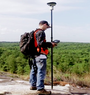
The Global Positioning System is a satellite-based system established and managed by the Department of security. These surveys are constantly correct to the sub-centimetre level. When the GPS base is established on a known longitude and latitude or if forward processing is applied to the base station, we can conveniently provide uniform coordinates for GIS mapping or any other application that requires coordinates based on longitude and latitude, UTM zone, standard zones or any of the State Plane Zone and map projections.
We are a foremost name in the industry, engaged in providing tremendous Land Survey services. The land surveys offered by us are helpful in determining the terrestrial and three dimensional positions of points, angles between lands and distances. We employ trigonometry, geometry, engineering, arithmetic, law and physics during the implementation of these services. Our services are widely acceptable by the clients.